Los Angeles is known for its energy, sprawl, and cultural pull, yet just beyond the freeways sits one of Southern California’s most accessible outdoor spaces. Angeles National Forest stretches across hundreds of thousands of acres and offers a rare mix of proximity and wildness.
From paved walking paths and picnic areas to high-elevation trails and remote backcountry camps, this forest serves casual visitors and serious hikers alike.
This guide breaks down where to go, what to know, and how to experience the forest responsibly while covering every essential detail.
Why Angeles National Forest Matters to L.A.
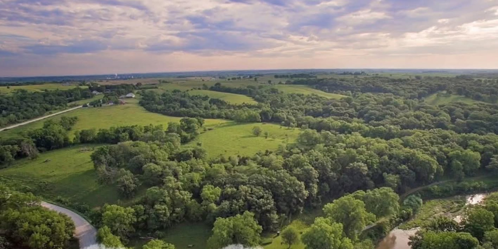
Instagram | angelesnatl | The Angeles National Forest blends 700,000 acres of recreation with deep ecological value.
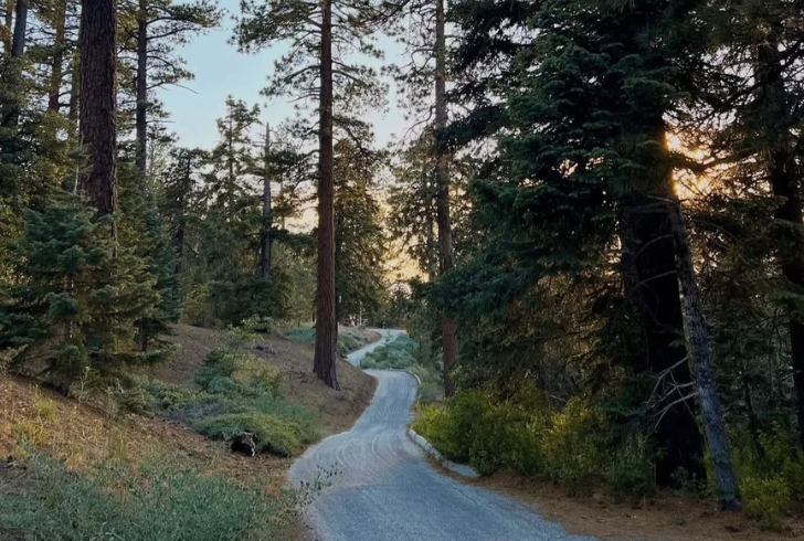
Griffith Park and Kenneth Hahn State Recreation Area provide easy green space close to the city. Still, those looking for broader views, quieter trails, and deeper contact with nature often head north. Angeles National Forest covers more than 700,000 acres and includes over 557 miles of trails. Often described as L.A.’s backyard playground, it offers far more than recreation. It holds ecological value, cultural history, and some of the most varied terrain in Southern California.
Visitors often encounter wildlife such as deer, owls, rattlesnakes, and amphibians like the California newt. Seasonal changes bring misty winter mornings, hot exposed summer climbs, snow near Mt. Waterman, and swim-friendly stretches of the San Gabriel River.
Forest supervisor Michael J. Rogers once warned that the forest could be “enjoyed and loved to death,” noting that overuse threatens shaded streams, wildlife, clean air, and solitude. That reminder still applies. Every visit comes with the responsibility to protect what makes the forest special.
Quick Geography Overview
Angeles National Forest is federally managed land overseen by the U.S. Forest Service. Its boundaries stretch from near Gorman and the 5 Freeway in the north to areas just above Claremont in the south. The forest spans parts of the Sierra Pelona Mountains and the San Gabriel Mountains, which run roughly 60 miles from Newhall to Cajon Canyon.
Elevation ranges from about 1,200 feet to 10,064 feet. The highest point is Mt. San Antonio, widely known as Mt. Baldy.
The area has been home to Indigenous communities for thousands of years and supports species found only in this region. These include the San Gabriel manzanita, big cone Douglas fir, and the endangered mountain yellow-legged frog. About 14% of the forest qualifies as old-growth, with white fir, lodgepole pine, Jeffrey pine, and ponderosa pine standing for more than a century. Jeffrey pine bark often carries a butterscotch or vanilla scent.
Protected Wilderness Areas
Five designated wilderness areas fall within the forest. These areas receive the highest level of federal land protection:
1. Cucamonga Wilderness
2. Magic Mountain Wilderness
3. Pleasant View Ridge Wilderness
4. San Gabriel Wilderness
5. Sheep Mountain Wilderness
Each offers a different experience. Cucamonga Wilderness supports bighorn sheep, while Magic Mountain occasionally sees California condors passing through.
What to Bring Before Heading Out
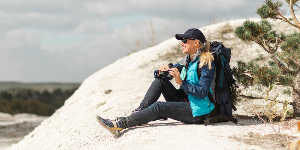
Instagram | angelesnatl | Hikers and campers must manage their own water and track seasonal dining hours.
Preparation matters due to limited services and changing conditions.
Transportation readiness
Arrive with a full tank of gas or a fully charged vehicle. Gas stations and charging points are not available within the forest.
Food and water
Day hikers should carry all required water unless planning to filter from a stream. Campers must confirm whether drinking water is available at their campground. Food options inside the forest are limited to places such as Camp Williams Cafe, Cosmic Cafe, Adams Pack Station, and Top of the Notch restaurant, all with seasonal hours.
Day pack essentials
Many hikers follow the “10 essentials,” while others tailor gear to the day’s conditions. Search and rescue teams recommend packing enough supplies to spend an unexpected night outdoors.
Parking passes
Most areas require an Adventure Pass:
$5 for a single day
$30 annual pass
America the Beautiful pass accepted
Some Wrightwood-area sites require a Big Pines parking pass managed by Mountain High.
Getting There and Road Conditions
Most trailheads and day-use areas are accessed via the 66-mile Angeles Crest Highway (State Route 2). Although the speed limit reaches 55 mph in sections, slower driving allows safer travel and better views.
State Route 39 leads north from Azusa toward Crystal Lake and the San Gabriel River. The road features steep drop-offs and seasonal wildflowers. A landslide in 1978 severed its connection to Highway 2, turning it into a long dead-end route. Repairs remain unlikely due to cost and environmental concerns.
Important update
As of December 31, 2025, Angeles Crest Highway is closed 3.3 miles east of Newcomb’s Ranch to State Route 138 due to storm damage. Some trails and campgrounds may be inaccessible. Road conditions should always be checked in advance, especially during winter.
Mountain driving etiquette applies here. Slower vehicles are expected to use turnouts. Some sections require daytime headlight use. Mapping apps may direct drivers onto dirt fire roads or off-road routes that are not suitable for standard vehicles. When unsure, contacting a ranger station is advised.
Key Safety and Planning Notes
Cell service
Cell reception is unreliable. Visitors should share trip details with a trusted contact and leave written information on the car dashboard.
Emergency response
The forest includes 23 fire stations. Volunteer search-and-rescue teams handle most hiking emergencies. Helicopter rescues do not involve charges, though donations help keep these services operating.
Fire rules
Fire and stove restrictions change with wildfire risk. Campfire permits are free but required when fires are allowed.
Weather awareness
Temperatures vary widely. Winter nights above 6,000 feet often fall below freezing, while summer heat can exceed 100 degrees. Temperature drops roughly 3.5 to 5 degrees for every 1,000 feet gained in elevation. After rainfall, trails may be damaged and river crossings more dangerous.
Closures
Trails burned in the Eaton fire remain closed and are not included in this guide.
Leave No Trace
Visitors should pack out all waste, respect wildlife, and avoid disturbing natural features. This practice protects the forest for future generations.
Easy Adventures for Relaxed Visits
Instagram | ontrailwithcesar | Families and beginners can enjoy easy, water-filled hikes like West Fork and San Antonio Falls.
Families, beginners, and those seeking a calm day outdoors will find many accessible options.
Easy Hiking Trails
1. City and valley views - Mt. Wilson Observatory paths, Crystal Lake walking path
2. Tall trees - Joatngna Trail (Elfin Forest Trail), Buckhorn Campground paths
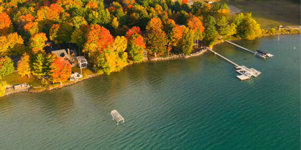
3. Water features - West Fork National Scenic Bikeway, San Antonio Falls Trail, Gabrielino Trail to Gould Mesa
4. Rock formations - Mt. Hillyer via Silver Moccasin Trail, Mt. Hillyer from Horse Flats Campground
Easy Campgrounds
These sites are simple to reach and often include piped water. Fees generally range from $12 to $30 per night.
1. Appletree Campground
2. Buckhorn Campground
3. Chilao Campground
4. Coldbrook Campground
5. Crystal Lake Campground
6. Los Alamos Campground (reservations required)
7. Monte Cristo Campground
8. Table Mountain Campground
All offer picnic tables, fire rings, vault toilets, and allow dogs. Seasonal closures apply to higher elevations.
Extra Stops Worth Visiting
Several nearby attractions add variety to forest trips:
1. Antelope Valley California Poppy Reserve
2. Bear Divide Banding Station
3. Camp Williams
4. Cali Splash Park at Castaic Lake
5. Elizabeth Lake Day Use
6. Jackson Lake
7. Mt. Wilson Observatory
8. Placerita Canyon Nature Center
9. Stonyvale Picnic Site
10. Vasquez Rocks Nature Center
11. Wildwood Picnic Area
Moderate Options for Regular Hikers
Those ready to move beyond city trails will find moderate hikes and camps that require planning but no technical skills.
Moderate Hiking Trails
1. Views - Josephine Peak, Stoddard Peak, Throop Peak, Vetter Mountain
2. Forest routes - Mt. Baldy Notch via Manker Flat, Mt. Waterman Loop
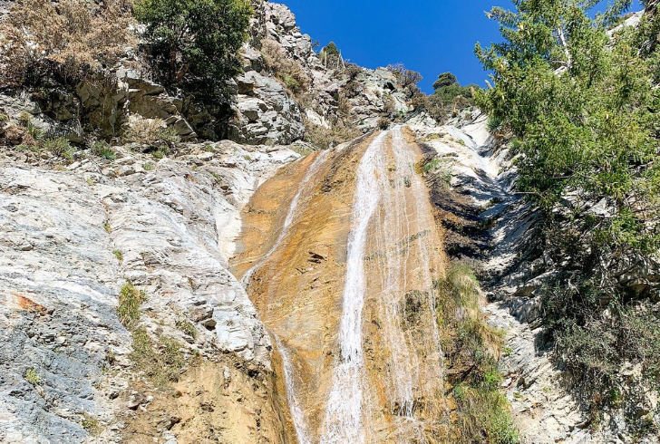
3. Waterfalls - Switzer Falls, Sturtevant Falls, Trail Canyon Falls
4. Rock features - Devil’s Chair Trail, Castaic Rock Trail
Moderate Campgrounds
These sites may lack water or require short hikes:
1. Cooper Canyon Trail Camp
2. Gould Mesa Trail Camp
3. Glenn Camp Campground
4. Horse Flat Campground
5. Oak Flat Campground
Fees range from free to $12 per night. Dogs are permitted.
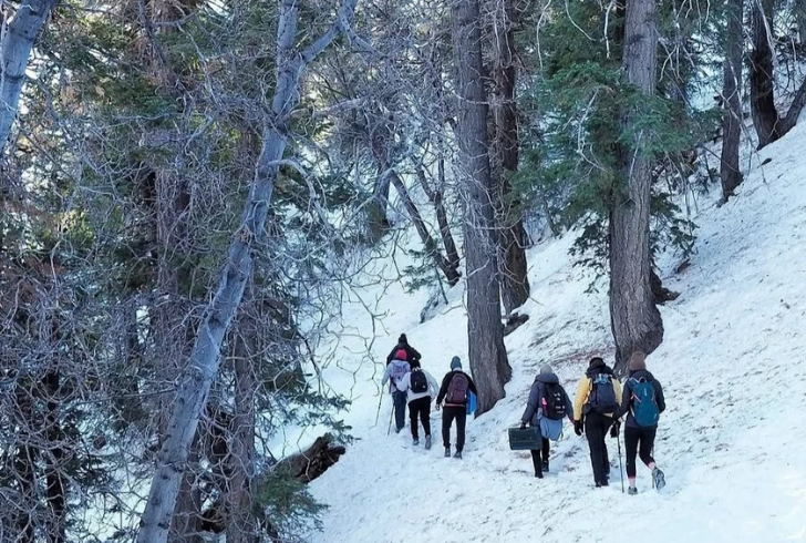
Advanced Routes and Remote Camping
Instagram | apas.music | Experienced hikers can explore demanding routes including Mt. Baldy and Crystal Lake.
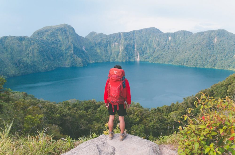
Experienced hikers with solid planning skills will find demanding trails and isolated camps.
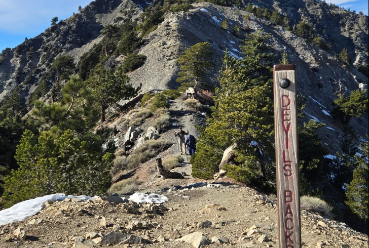
Advanced Hiking Trails
1. Crystal Lake to Mt. Islip
2. Mt. Baldy via Devil’s Backbone Trail
3. Mt. Baden-Powell
4. Cucamonga Peak (permit required)
5. Strawberry Peak
Snow and technical conditions are common in winter.
Backpacking Routes Near L.A.
1. Gabrielino National Recreation Trail (26 miles)
2. Silver Moccasin National Recreation Trail (53 miles)
3. Pacific Crest Trail sections through Angeles National Forest (about 176 miles)
Advanced Campgrounds
These require extra preparation and often lack water:
1. Big Rock Campground
2. Bear Camp
3. Hoegees Trail Camp
4. Little Jimmy Trail Camp
5. Messenger Flats Campground
6. Mt. Pacifico Campground
7. Sawmill Campground
8. Southfork Campground
9. Sulphur Springs Trail Camp
10. Spruce Grove Trail Camp
Los Angeles offers a rare contrast: a global entertainment hub paired with protected wild spaces only a short drive away. Angeles National Forest provides that balance, offering quiet trails, wildlife sightings, and room to breathe.
reserving these experiences depends on responsible use, awareness, and care. Protecting the forest ensures that shaded creeks, pine-scented air, and open views remain part of Southern California’s identity for decades to come.